AI for Earth 2 - Forest Health
Detect excess water in European forests endangering the fragile balance of one of the largest woodland ecosystems via open satellite data.
Premium participation: Get 1-on-1 Mentoring & Guidance
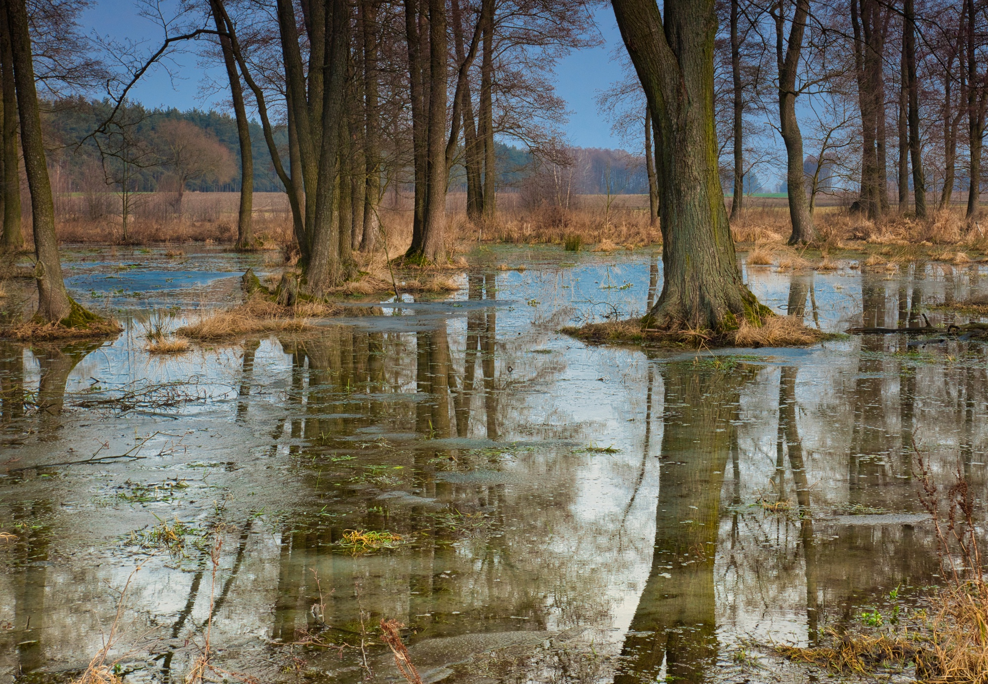
Try a free mentoring sessionForest flooding detection in satellite data from Latvia
Challenge completed. Watch the recording of the AI for Earth 2 final results presentations to discover that the teams of AI for Inland Floods Prediction and AI for Forest Health came up with:
About the Challenge
In this Challenge, we combine open satellite data with meteorological data and registry data on forest clearings due to excess water in Latvia. The goal is to build a model that can detect excess water in forests from satellite data.
While a lack of water destroys forests, too much water can kill them too. When trees that are not adapted to flooding are under water for an extended period of time, they weaken and die. Beavers are often the culprit in Latvia. To prevent a large section of forest gradually succumbing to the water, forestry services usually cut an area with excess water clear.
For this challenge, FruitPunch AI teamed up with SUN - Space Hub Network, the geospatial analytics company Baltic Satellite Service and Forest Radar, who use machine learning and satellite imagery for advanced forest intelligence.
Info session
Our challenge partner

GOAL: Build a machine learning model that can detect excess water in forests from satellite data to alert forestry services
The goal of the project is to develop a system which triggers an alert when a forest risk factor of excess water is noticed. A forest manager then receives information through an http accessible API. This allows integration of the system as a service into most existing forest management and planning software and creates timely awareness for the forest owners. Excess water is the 3rd most common cause of forest damage in Latvia.
▶ Gather and clean satellite data for the larger forests of Latvia
▶ Use GIS to map water levels in forests, enrich data with information from ground stations.
▶ Define risk areas. Research detection of dangerous water levels.
▶ Train a computer vision model to detect risk areas, for example
- CNN’s
- Yolov5
- other object segmentation models
▶ Create a real time map of Latvia with highlighted risk areas. Inference speed will be defined with stakeholders.
Who are we looking for?
We are looking for data science & AI engineers with a good foundation in computer vision. Previous experience in analyzing satellite imagery would be of great advantage, but don’t worry if this would be your first one. Are you interested in entrepreneurship? We might have a special surprise for you too.
You will collaborate with a diverse team of up to 50 international collaborators in subteams. You can join as a contributor (~12 hours per week commitment for 10 weeks) or coach (2-4 hours per week, only for experienced ML professionals)
We’ll organize 2 masterclasses on relevant topics during the challenge to bring you up to speed.
Did you know
🌲 Excess water is the 3rd most common cause of forest damage in Latvia
🦫 One of the main culprits are the beavers, their dams are jamming streams flooding nearby forests
🦫🦫 Having no domestic beaver population, 2 pairs of Norwegian beavers were released in 1927 into the Latvian wilderness
🦫🦫🦫 Until 1960 the population was estimated at only about 100 animals. But since the 60ties a rapid increase has taken place.
🦫🦫🦫🦫🦫🦫🦫🦫🦫🦫🦫🦫 Today, the beaver population in Latvia is estimated to be about 100,000 animals spread over the entire country.
Timeline
Application Deadline: 19 June 2022
Challenge Kick-off: 20 June 2022
Midterm Presentations: 01 August 2022
Final Presentations: 22 August 2022